
Mosque of Qal'at Bani Hammad
History
Near the longitudinal center of Qalat Bani Hammad, to the south, is where you'll find this mosque.
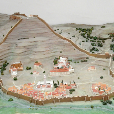
The fortified palatine city of Qal'at Bani Hammad (Arabic: ), also known as Qal'a Bani Hammad or Qal'at of the Beni Hammad (among other variations), is located in Algeria. The original capital of the Hammadid dynasty, now in ruins, was located there in the 11th century. At an elevation of 1,418 meters (4,652 feet), it is located in the Hodna Mountains northeast of M'Sila and receives a lot of water from the neighboring mountains. The location is in the Maghreb region, close to the town of Maadid (also known as Maadhid), some 225 kilometers (140 miles) southeast of Algiers.
Under the name Al Qal'a of Beni Hammad, it was included as a World Heritage Site by UNESCO in 1980. It was described as "an accurate depiction of a fortified Muslim city."
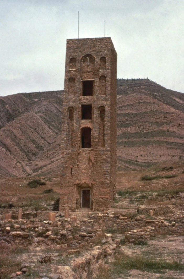
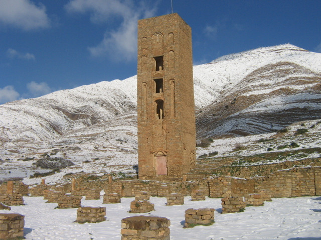
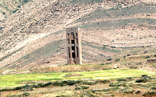
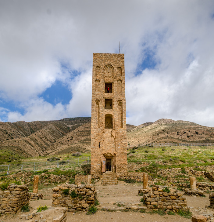
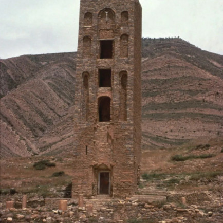
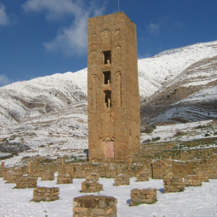
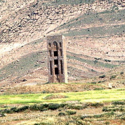
A 7-kilometer (4-mile) long line of walls surrounds the settlement. Four apartment complexes and Algeria's second-largest mosque after Mansurah are located inside the walls. It has a 20-meter-tall tower with a similar design to the Grand Mosque of Kairouan (66 ft).
Urban and Architectural
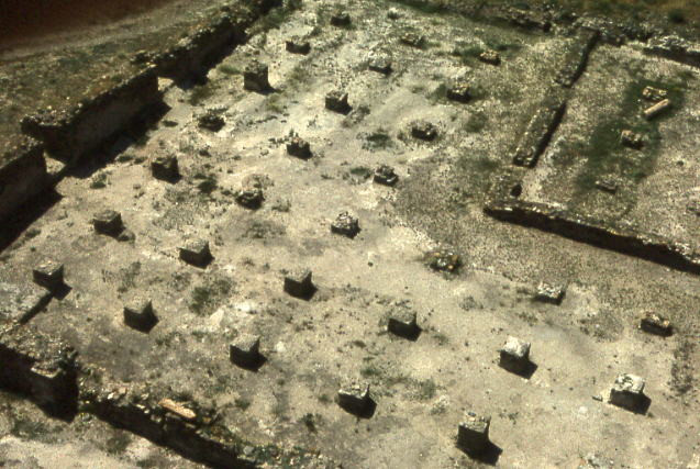
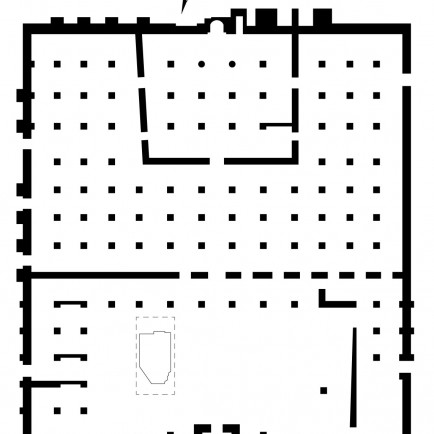
The mosque is quite big, with a rectangular layout that is 64 meters long from north to south and 56 meters broad from east to west. The mosque's longitudinal axis is parallel to the meridian running from north to south. Public entrances are found in the east and west walls, which lead onto the mosque courtyard, and a minaret is situated in the middle of the north wall.
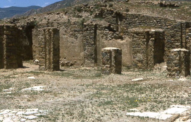
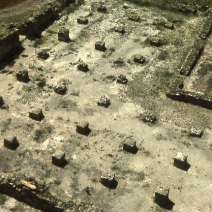
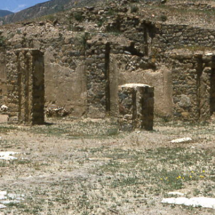
The vast sahn, which is surrounded by arcaded galleries, leads to the hypostyle prayer hall, which is split into a grid that is thirteen aisles wide and eight bays deep by columns. The mosque had a sizable maqsura that was now gone; it was located in front of the qibla niche on the south wall and was five bays wide and four bays deep. If it weren't currently totally destroyed, the Qalat Beni Hammad mosque would be one of the biggest in all of Algeria.
Description
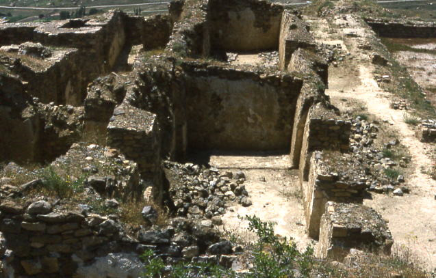
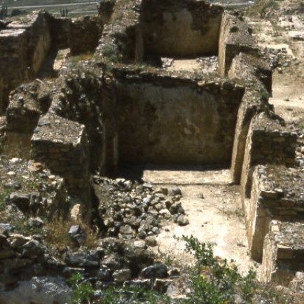
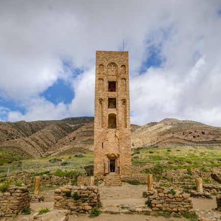
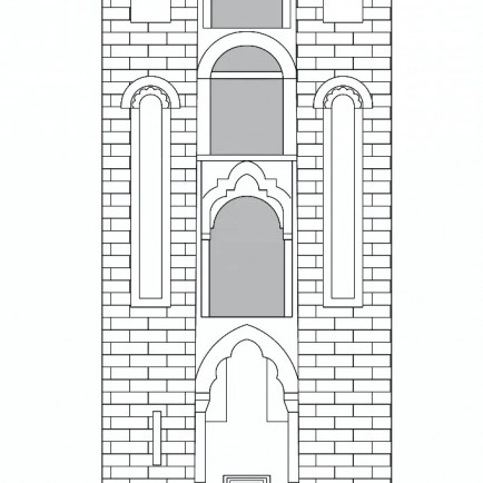
Unfortunately, practically all of the buildings that can be seen at the Qalat Bani Hammad today only exist as the foundations of destroyed buildings without roofs. The minaret of the large mosque in the qalat is the only construction that has survived above ground level beyond the remains of a plan. A masonry building, the minaret is made of stone bricks set in a coursed ashlar design. The minaret's square design is reminiscent of examples from Andalusia, but the exterior's arrangement of arches is most likely a Fatimid Egyptian influence.
References
https://www.archnet.org/sites/16739
https://en.wikipedia.org/wiki/Qal%27at_Bani_Hammad
https://earth.google.com/web/search/+Qal%27at+Bani+Hammad/@35.82099733,4.78967852,989.87842064a,146.38339007d,35y,-9.01597024h,0t,0r/data=CigiJgokCaLuIvPw6UFAEdZePsOH6EFAGQwYL0q2NxNAIRT3xgseFxNA
Details
Location
RQCQ+FRM Beni Hammad Fort, Maadid, Algeria
Worshippers
1750
Owners
Hammad ibn Buluggin
Architect Name
Year of Build
1007-1008/397-398 AH 1062-1089/454-481 AH (modified) second quarter 12th/early 6th century AH (modified) 1974 (minaret renovated)
Area
3500
Drawings
Map
History
Near the longitudinal center of Qalat Bani Hammad, to the south, is where you'll find this mosque.
The fortified palatine city of Qal'at Bani Hammad (Arabic: ), also known as Qal'a Bani Hammad or Qal'at of the Beni Hammad (among other variations), is located in Algeria. The original capital of the Hammadid dynasty, now in ruins, was located there in the 11th century. At an elevation of 1,418 meters (4,652 feet), it is located in the Hodna Mountains northeast of M'Sila and receives a lot of water from the neighboring mountains. The location is in the Maghreb region, close to the town of Maadid (also known as Maadhid), some 225 kilometers (140 miles) southeast of Algiers.
Under the name Al Qal'a of Beni Hammad, it was included as a World Heritage Site by UNESCO in 1980. It was described as "an accurate depiction of a fortified Muslim city."
A 7-kilometer (4-mile) long line of walls surrounds the settlement. Four apartment complexes and Algeria's second-largest mosque after Mansurah are located inside the walls. It has a 20-meter-tall tower with a similar design to the Grand Mosque of Kairouan (66 ft).
Urban and Architectural
The mosque is quite big, with a rectangular layout that is 64 meters long from north to south and 56 meters broad from east to west. The mosque's longitudinal axis is parallel to the meridian running from north to south. Public entrances are found in the east and west walls, which lead onto the mosque courtyard, and a minaret is situated in the middle of the north wall.
The vast sahn, which is surrounded by arcaded galleries, leads to the hypostyle prayer hall, which is split into a grid that is thirteen aisles wide and eight bays deep by columns. The mosque had a sizable maqsura that was now gone; it was located in front of the qibla niche on the south wall and was five bays wide and four bays deep. If it weren't currently totally destroyed, the Qalat Beni Hammad mosque would be one of the biggest in all of Algeria.
Description
Unfortunately, practically all of the buildings that can be seen at the Qalat Bani Hammad today only exist as the foundations of destroyed buildings without roofs. The minaret of the large mosque in the qalat is the only construction that has survived above ground level beyond the remains of a plan. A masonry building, the minaret is made of stone bricks set in a coursed ashlar design. The minaret's square design is reminiscent of examples from Andalusia, but the exterior's arrangement of arches is most likely a Fatimid Egyptian influence.